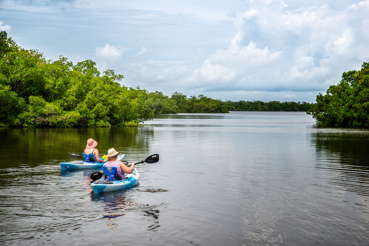
Southwest Florida has everything you need for the perfect kayaking trip: warm, sunny climate, equipment rentals, sheltered inland waterways, shallow waters, and lots of native wildlife. It is also home to the Great Calusa Blueway, a wonderful resource for all types of non-motorized transport.
Lee County has miles of sheltered bays, rivers, backwaters, and shorelines that lend themselves to kayaking, canoeing, and stand-up paddleboarding. The dry winter climate, year-round sunshine, and plethora of paddling opportunities attract kayakers and paddlers to the Great Calusa Blueway from all over the world.

Kayak Paddling Regions of the Great Calusa Blueway
The Great Calusa Blueway is separated into three kayak paddling regions, each with their own maps and attractions:
- Pine Island Sound – Malachi Pass includes many uninhabited islands and cays along with Captiva, Sanibel, Pine Island, and Cayo Costa.
- The Caloosahatchee River and its tributaries are large enough to warrant its own section. The broad Caloosahatchee is well used by power boats but the many tributaries are a peaceful paradise.
- Estero Bay around Fort Myers Beach offers miles of undeveloped waterways with canopies of oaks and shady mangrove tunnels along with the Imperial River, Bonita Springs and Lovers Key State Park. You can book kayaks and canoes from the state park concession by the hour or by the day
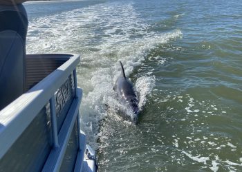
The coastal waters are home to mangroves and an abundance of marine life such as manatees, dolphins, fish, and crustaceans. The freshwater and brackish waters are lined with established trees including live oaks draped with Spanish moss. They are teeming with fish, turtles, and wading birds, making every trip a journey of discovery, at one with nature.

High overhead you may spot soaring eagles, ospreys, and rare birds of prey. At water level you may come across a flock of roseate spoonbills sifting the shallow water of a lagoon, or rare wood storks stalking the water-edge in search of a tasty meal. Spot grazing manatees and nesting herons, ibis, and egrets in collective rookeries where they nurture their young.
Free Maps for Florida’s Great Calusa Blueway Paddling Trail
In 2002, Florida’s Lee County Parks and Recreation developed the 190-mile Great Calusa Blueway Paddling Trail. Named after the indigenous water-based Calusa Indians, it is generally sheltered from winds and is around four feet deep.
The paddling trail was funded partly by tourist development tax dollars as part of beach and shoreline enhancement around Southwest Florida. The aim was to provide a waymarked route for canoes and kayaks to explore in relative safety. It is ideal for everyone, from first-time kayakers to advanced professionals.
The Paddling Trail covers three main rivers and their tributaries and includes Estero Bay, Pine Island Sound and many coastal islands around Fort Myers Beach. There are lots of different interconnecting trails.
Fortunately, there are free downloadable maps of the Calusa Blueway to help you plan your route!
Phase 1 Trail Map
Map shows all three regions but covers only Estero Bay in detail.
Phase 2 Trail Map
Map shows all three regions but covers only Pine Island and Matlacha Pass in detail.
Phase 3 Trail Map
Map shows all three regions but details only the Caloosahatchee River and its tributaries.
Pine Island Paddlecraft Launch Trail Map
Map shows details of Pine Island, Sanibel, Captiva, Cayo Costa, Bokeelia, St. James City, Matlacha, and Cape Coral.
You can also request a free set of maps by mail or download the app.
Equipment Rental on the Great Calusa Blueway
Visitors to the Fort Myers, Florida area and first-time kayakers will find over 30 outfitters serving the paddling trail by renting out equipment. Most of them will deliver your kayak and equipment to an agreed boat ramp. Many outfitters also offer guided kayaking tours which are ideal for learning about local wildlife as you explore the area.